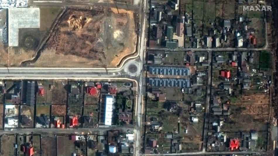
How AFP has used data analysis to cover the Ukraine war / Photo: © Satellite image ©2022 Maxar Technologies/AFP
 Henry the hero as New Zealand level England series in style

 Gill to skipper India against England, Kohli to play if fit

 UK's Starmer mulling 'political realities': senior minister

 France presses ahead with music festivals despite extreme heat
 Springboks recall 'outstanding' Papier for Nations Championship

 Bezzecchi out of Czech MotoGP after slapping steward

 FIFA draws criticism as Infantino clocks up air miles at World Cup

 Japan stroll to victory over Tunisia in World Cup's 1,000th game
 Trump blames 'terrible vandals' for Washington pool renovation woes

 Man charged over suspected anti-Muslim attacks in Edinburgh
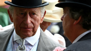 Britain's King Charles to reveal personal tax bill: reports

 Fly-half Love ready for All Blacks start after Super Rugby heroics
 Saudis seek to repeat Argentina World Cup 'miracle' against Spain
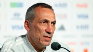
 Nagelsmann says Germany has higher ambitions than advancing to knockout stage
 US and Iran set for new talks after delay and deadly strikes

 Germany into World Cup last 32 after late comeback, Dutch thrash Sweden

 Albanian protests against Trump-linked resort swell

 Burn dons cowboy boots as England unwind at World Cup

 France's Saliba says playing through the pain at World Cup
 Counter-terror cops probe suspected anti-Muslim 'attacks' in Edinburgh

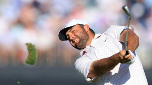
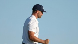
 Clark begins with bogey as McIlroy charges at US Open
 Specter of military escalation hangs over Colombia vote

 Jamieson strikes as New Zealand eye series-levelling win despite Root heroics

 Netherlands thump Sweden in Houston to get World Cup liftoff
 Jamieson strikes as New Zealand eye series-levelling win against England

Since Moscow launched its full-scale invasion of Ukraine exactly four years ago, AFP has used open-source data and satellite imagery to support reporting by its teams on the ground.
As both sides mark the start of the conflict's fifth year, here is how that information is being used to provide context and information, helping cut through the fog of war.
- Geodata -
Geospatial data -- data describing things based on their location -- has been particularly helpful in coverage of the war.
It has made it possible to map how territorial control by Russian and Ukrainian forces is evolving, and to show movements of the front line in areas that are difficult to cover.
AFP uses material supplied by the Institute for the Study of War (ISW), which works with the American Enterprise Institute's Critical Threats Project (CTP).
These two American think tanks assess and detail daily developments in the conflict using statements from Ukrainian and Russia military commanders, publications by military observers, and satellite images.
They provide the corresponding geospatial files to media outlets, including AFP.
The two organisations sort Russian actions into four categories: territory occupied by Russian troops, areas where attacks and operations are underway without full control, Russian territorial claims that ISW has neither confirmed nor refuted, and, more recently, Russian infiltration missions into Ukraine.
AFP has archived these files and tracked evolutions in these categories from the very first days of the conflict.
- How it's used -
Initially, this data was used to produce maps.
In September 2022, AFP also used it for the first time to quantify the extent of the Russian occupation in four Ukrainian regions that Russia has claimed (Donetsk, Lugansk, Kherson, and Zaporizhzhia).
Since then, AFP has automated area calculations of the geographic files supplied by ISW and cross-references them with the size of Ukrainian regions.
That is done using data by the collaborative mapping project OpenStreetMap.
This has allowed AFP to calculate the size of territory gained or lost by the Russian army.
That includes fully controlled territory, partially controlled areas, as well as more vague Russian territorial claims that ISW has not yet been able to verify.
Russia occupied around 19 percent of Ukrainian territory as of Tuesday, according to this analysis.
Around seven percent, including Crimea and parts of the Donbas, was already under Russian control before the invasion began in February 2022.
- Eyes in the sky -
AFP also enhances its coverage with satellite imagery.
Analysis of satellite images by Maxar Technologies (now Vantor), a US software company specialising in spatial intelligence, proved crucial in covering the Bucha massacre at the start of the war in early April 2022.
At the time, an AFP team observed at least 20 bodies of men in civilian clothing lying in the streets of this town northeast of Kyiv, which Ukrainian soldiers had just retaken from the Russians.
Russia claimed the bodies had been placed there after its troops withdrew, but Maxar's images from mid-March seriously undermined that version of events.
Satellite images have since helped shed light on situations on the ground.
In June 2023, they were used to monitor the Dnipro River's water levels around the Zaporizhzhia nuclear power plant after the destruction of the Kakhovka dam.
H.Weber--VB